The ground segment's moment
Twelve months ago, the space industry's favorite topic was launch. This month, it is the ground. In September, two major ground network programs were announced within days of each other. In early October, the Mitchell Institute, the think tank of the US Air & Space Forces Association, published "War at the Speed of Information", a report urging the United States to field hybrid RF/optical space communications within five years, on the grounds that military sensors now generate two hundred times more data than twenty years ago and that legacy radio-frequency downlinks have become the operational bottleneck. At the International Astronautical Congress this week, session after session is devoted to the architecture and dimensioning of optical ground segments for multi-orbit constellations.
This is a welcome and long-overdue convergence. Satellites generate more data than radio can economically carry to the ground; laser links carry it; the ground segment decides where and when it lands. The industry has understood that the ground is no longer plumbing. It is the product.
But walk through any of these architectures, announced or presented, and one variable is treated as a footnote everywhere: the atmosphere itself. Stations are being financed. Orchestration software is being written. Site diversity is being optimized. And almost all of it is being dimensioned on climate maps, as if the sky were a static input and we didn’t just experienced the hottest summer in recorded history.
The bottleneck moved
The most instructive engineering document published this year on this question is not a press release. It is a systems analysis from the Jet Propulsion Laboratory. Its conclusion deserves to be quoted directly: the bottleneck has shifted "from peak line rate to repeatable service under weather, acquisition, scheduling, and operations constraints."
Read that again from the buyer's side. No one buys an optical ground station to demonstrate a record data rate. They buy it to pass data, every day, under any sky. The JPL study's normalized economics make the point brutally: at representative station costs, the fixed-cost component of delivered data is dominated not by how fast the link goes when it is up, but by how often it is up, the usable pass time, the duty factor, the weather-diverse availability of the network. Bandwidth is an engineering problem, largely solved. Availability is a weather problem, and it is where the money is.
Climatology is not an SLA
Every optical ground network announcement this year includes a variant of the same figure: 99% availability, derived from the statistics of cloud cover. These figures are real, back in 2017 an ESA-commissioned study from the DLR found that four to five geographically distributed European sites can achieve around 99% availability against cloud cover, but they are population statistics, not operating guarantees. They describe the climate. Operations happen in the weather.
The distinction is not academic. A network routing engine that knows, twenty minutes ahead, that the cloud edge will cross its primary site, and that turbulence is degrading the Fried parameter at its backup, routes differently than one that knows only that the primary site is usually clear in October. The first is a service. The second is a hypothesis wearing a Service-Level Agreement.
This is the missing layer of every optical ground architecture announced in 2026: measured, real-time, site-by-site knowledge of the atmospheric channel, cloud cover, optical turbulence day and night, water vapor, feeding the routing decision. The Mitchell Institute report names exactly these challenges among the gates to operational hybrid architectures: weather effects, precision pointing, routing flexibility, resilient multipath transport. Three of the four live in the atmosphere.
What we built, and why
Miratlas was founded in 2018 on a simple inversion of the industry's default: instead of modelling the atmosphere to estimate availability, measure it continuously, and let the measurement drive both the design and the operation of the network.
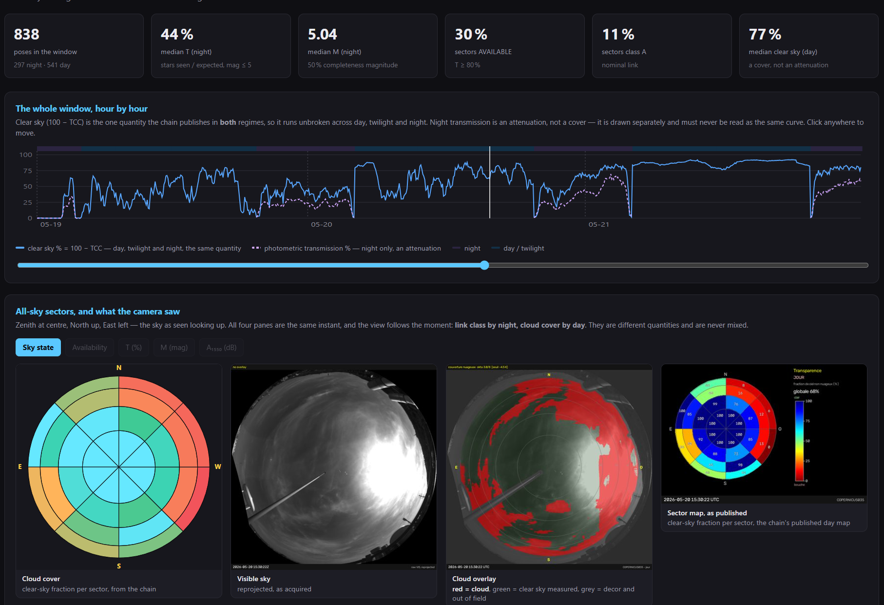
Eight years later, that inversion is an industrial reality: more than 60 Sky Monitor stations across 20 countries, the only industrial network measuring optical turbulence day and night alongside cloud cover, aerosols and water vapor; a qualified database of more than 20 TB growing by roughly a terabyte per month; forecasting engines delivering short-horizon predictions of cloud and turbulence conditions; and an API, the DataHub, through which operators subscribe to the state of the sky at each of their sites. To access the demo : data.miratlas.com/demo — live, no account required]).
Two of the network's properties matter more than its size. The first is continuity: turbulence does not switch off at dawn, and neither do we, day-and-night measurement is the difference between knowing your site and knowing half of it. The second is history: every month of measurement deepens the only calibrated, cross-site, multi-year record of the optical channel that exists. Models can be rented. That time series must be earned.
Proof in a hard place: Southeast Asia
The objection we hear most often is that the difficult regions, the tropical and equatorial zones where data-center deployment is most active, make optical ground links hopeless. Last month we ran the exercise with our LaserCom Pathfinder tool over one of the hardest of them: Southeast Asia, under monsoon regime. Twenty-five sites across the region, chosen from interconnection points rather than deserts, because a ground station in the Atacama does not interconnect a data center in Singapore.
The result: 98.32% average annual availability, with the shortfall concentrated almost entirely in the June-to-September monsoon, and largely recoverable by extending the regional plate toward drier sites in eastern India and northern Australia . (Read the study "Why geographic diversity of OGS sites is essential: proof from Southeast Asia").
The lesson is not that optical alone suffices, it does not, and the monsoon says so. The lesson is that a measured, dimensioned regional network plus radio backup delivers an honest availability figure that an operator can plan, engineer and sell. That is what hybrid RF/optical architecture means in practice: not a slogan from a think tank, but a routing decision taken twenty minutes before the cloud arrives, on data.
One network, many skies
The economics of a measurement network compound in a way single-purpose infrastructure does not. The same calibrated data that routes laser links serves solar production forecasting, contrail monitoring for aviation climate studies, air-quality and atmospheric modelling, and site characterization for astronomy and space surveillance. Each application deepens the dataset; the dataset serves them all. We sell one thing: the sky, measured.
The question to carry into every architecture
The five-year clock that the Mitchell Institute set for the United States applies to everyone; architectures and standards are being decided now, this quarter, at conferences like the ones happening this month. So here is the single question we would ask of every optical ground architecture presented between now and then, including our own contributions:
Which layer of this network assumes the sky, and which layer measures it?
If the answer is "assumes", the design is not finished. If the answer is "measures", welcome to the layer we have been building since 2018. The sky is the last unmeasured infrastructure in the space economy. It will not stay that way for long.
Jean-Edouard Communal is the co-founder and CEO of Miratlas. Live atmospheric data from the Miratlas network is available without registration at data.miratlas.com/demo.